
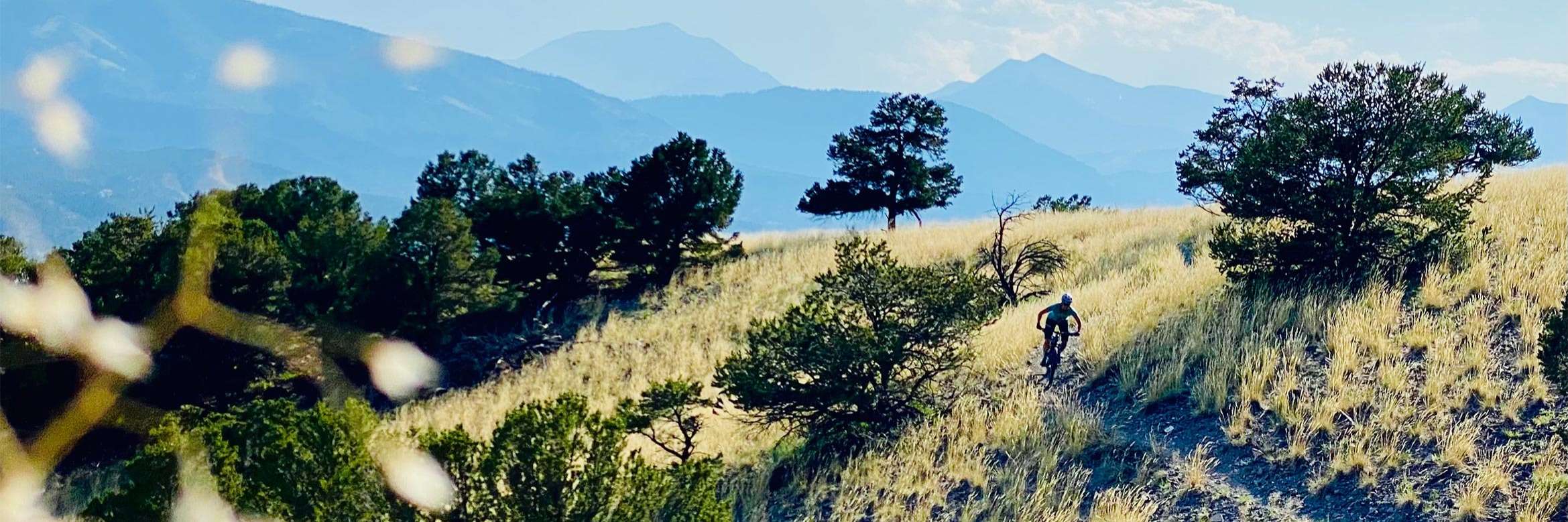
Local Trail Highlights

Check out our favorite trail recommendations! Salida has over 40 miles of trails accessible from town, plus many miles of high alpine riding. The Arkansas Hills and Methodist Mountain systems are our local ride-from-town trails and are rideable almost year-round. In the summer, the Monarch Crest, Rainbow Trail and the Colorado Trail offer awesome single track with unbeatable views and cooler temperatures. And our neighbors, in Buena Vista, they are also quickly expanding their local trail system.

Stop in the shop to get our custom map, and we’ll point you in the direction for everything from a quick 1/2 hour fast loop to multi-hour/all-day rides. We recommend MTBProject as your trail app of choice, as we have created suggested loops with good riding descriptions.

Thanks to our local trail organization, Salida Mountain Trails, for building and maintaining our local ride-from-town trail network!

* EBIKES: KNOW BEFORE YOU COME: In the Salida area E-Mountain Bikes are only allowed on designated motorized trails, as most of our trails are managed by either BLM or FS. There is no single track on S-mtn and lower Methodist open to E-mtbs currently. Roads, yes. Single track, no. Please adhere to the current rules set by the land managers (BLM and FS). As far as single track is concerned only the Rainbow trail (the real deal, not Little or Double Rainbow), Greens Creek, Agate Creek, and the Monarch Crest from Monarch Pass to Marshall Pass are 'motorized' single track open to moto's and thus e-bikes, near Salida. Please follow the rules, regardless if you agree with them or not... *

Listed below are some top trail recommendations:

Monarch Crest Trail (EMTB Friendly to Marshall Pass Rd)

The Monarch Crest Trail is the 11-mile section of Continental Divide Trail between Monarch Pass and Marshall Pass. Most bike riders ride it from Monarch to Marshall, and then continue on to do more bike riding. Many, many riders call the full ride they do the Monarch Crest. But for clarity, when staff from Absolute Bikes are talking about The Monarch Crest, we are referring to the 11 miles from Monarch to Marshall. The longer ride, which includes the Silver Creek Trail and alternately the Rainbow Trail, we refer to as The Classic Crest Route. One of the reasons that the Monarch Crest Trail is so wonderful is that it is very high. For about 6 miles of its 11 mile length, the Crest Trail is between 11,950 and 12,000 feet elevation. Which means that it is above treeline, and near the top of the Continental Divide ridge. The 360° views, the tiny high alpine flowers, and the rarified air make that stretch of trail pure rocky mountain magic.

Cottonwood Tour

Cottonwood Tour is one of our favorites! Ride it as a loop starting with a 7-mile dirt road climb up CR 175 (Ute Trail Road). The singletrack starts on Beasway and climbs a little more before the descent starts! Beasway leads into Rumba, which then leads into Cottonwood. When the trail intersects with Backbone and Sweet Dreams, take your pick depending on how your legs are feeling. Right on Backbone is a faster exit when you descend Lower Sand Dunes, whereas Sweet Dreams leads to Chicken Dinner for a sweet and yummy flowy descent off the Arkansas Hills. NOTE: Beasway has a seasonal closure Dec 15 - March 15 for wildlife.

S-Mountain - Chicken Dinner Loop

This is the classic favorite S-Mountain loop that climbs Frontside and follows the contours of the hills using Lil Rattler, Backbone, Sweet Dreams and then descends down Chicken Dinner. A great 10 mile loop!

Methodist Mountain - Spartans and Little Rainbow

The Methodist Mountain system is the "easiest" in the Salida area. It can be ridden as a larger loop from town, or smaller loops/out-and-back from the parking lot.

To ride the loop from the Little Rainbow Trailhead, follow above directions to the parking lot. Ride Spartan West to Spartan East and turn right on Little Rainbow for a nice 6ish mile loop. For a bit longer of a ride, take CR 110 north out of town and pedal a 2wd dirt road to the trailhead. Here you have options - our current favorite is to ride Spartan West, cross CR 110 to Spartan East until it meets up with Little Rainbow. Take a left on Little Rainbow and ride it until Race Track (or Lost or Dead Bird). The trail puts you at the Burmac trailhead and you can then ride back to town - take the deer trail on the left side of the highway, and cross 50 at the Forest Service office, then take CR 105 back to town for less traffic.

Bear Creek - Rainbow

This ride starts with a 3-mile grind up a sometimes steep and loose high clearance 4-wheel drive road, but what follows is 6 miles of really good singletrack, with a sweet downhill back to the trailhead. Rated difficult because of that 3-mile grind up the road. Rainbow is a moto trail, so be prepared to encounter dirt bikes. * E-Bikes note: Rainbow is the only trail in Salida that is E-Bike Friendly. To ride this loop on an E-bike, ride up CR 101 Bear Creek to the Rainbow trail, across the Rainbow to either CR 108 or Sand Gulch 4x4 roads to get back to town.

Silver Creek - Rainbow Loop (EMTB Friendly)

Most locals ride this loop in May and June, well before the Monarch Crest opens up, or after it closes due to snow. It's a relatively easy nine or so mile ride up on Silver Creek Road, followed by 11.3 miles of great singletrack on the Rainbow Trail. Park on 285 where the trail ends and pedal 1/4 to the Mears Junction/Marshall Pass Rd. Stay left on Silver Creek Rd at the Shirley Site and go 5.5 miles to the Silver Creek Trailhead.

Turret Out-and-Back (Gravel)

Check out a piece of Colorado's mining history with this out-and-back ride to the ghost town of Turret. Start by riding up a sustained climb on CR 175 - stay left and continue on CR 175 at the junction with CR 182, and then take a left onto CR 184 and follow this until you reach Turret. This ride is approximately 25 miles in length with 3,300 feet of climbing, and the road condition is excellent (graded county roads).